Natchez Trace Civil War History
Several Civil War sites and battlefields can be found along or near the Natchez Trace Parkway. Two major areas are centered around the Battle of Shiloh and nearby Corinth, Mississippi and the Vicksburg Campaign.
Tennessee - Mississippi
Overview Map of Civil War Driving Tours (GPS routes)
Tennessee Civil War History Sites located along or near the Natchez Trace Parkway

This "summary preview" of each Tennessee Civil War History site includes the site name and directions from the Natchez Trace Parkway.

Exit the Natchez Trace Parkway onto Tennessee Highway 96 (milepost 438) and travel east 8 miles to Franklin. Follow signs to 1111 Columbia Avenue, Franklin, TN.

Exit the Natchez Trace Parkway onto Tennessee Highway 96 (milepost 438) and travel east 8 miles to Franklin. Follow signs to 1140 Columbia Avenue, Franklin, TN.

Exit the Natchez Trace Parkway onto Tennessee Highway 96 (milepost 438) and travel east 8 miles to Franklin. Follow signs to 1345 Eastern Flank Circle, Franklin, TN.

Exit the Natchez Trace Parkway onto Tennessee Highway 96 (milepost 438) and travel east 8 miles to Franklin. The cemetery is at 1345 Carnton Lane, Franklin, TN.
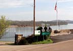
Exit the parkway near milepost 370 onto US 64 and travel west 29 miles to Clifton, TN.

If you are traveling south on the Trace, exit at milepost 370 onto US 64 and go west through Waynesboro and Savannah to the park area.
If you are traveling north on the Trace, exit at milepost 266 onto Mississippi Highway 145 near Tupelo, then go north on US 45, and travel north through Corinth and onto the park area. Or, in Alabama you can exit the Trace at milepost 320 onto US 72 and travel west to Corinth and then north to the park area.
Mississippi Civil War History Sites located along or near the Natchez Trace Parkway
This "summary preview" of each Mississippi Civil War History site includes the site name and directions from the Natchez Trace Parkway.

Corinth Civil War Interpretive Center
In Corinth, MS. If you are traveling north on the Trace, exit onto Mississippi Highway 145 near Tupelo, then go north on US 45 to Corinth.
If you are traveling south on the Trace, exit onto US 72 at milepost 320 and travel west to Corinth.

Brices Cross Roads National Battlefield Site
Near Baldwyn, MS. If traveling south, exit the Trace at milepost 282 onto Mississippi Highway 370 and travel west 11 miles to Baldwyn and then 5 more miles west to the battlefield site.
If traveling north, access US 45 north of Tupelo and travel north 12 miles to highway 370 and go west 1 mile.

Confederate Gravesites and Old Trace
On the parkway at milepost 269.4 - Old Trace, Top 30 Site

In Tupelo, MS. Exit the Trace at milepost 259.7 onto Mississippi Highway 6 (Main Street in Tupelo) and travel east 1 mile.

Near Raymond, MS. Exit the Trace at milepost 79 onto Mississippi Highway 467 and travel east to the town of Raymond. Continue through Raymond to Mississippi Highway 18. Turn right (west) on highway 18 and the Raymond Military Park will be on your right a couple of miles down the road.

Vicksburg National Military Park
Located west of the Natchez Trace Parkway in Vicksburg, Mississippi. I-20, Mississippi Highway 27 and U.S. 61 connect travelers from the Trace to Vicksburg.

Near Port Gibson, MS. Exit the Trace at milepost 41 onto Mississippi Highway 18. Turn left (south) on US 61 and drive into Port Gibson. From the courthouse area in Port Gibson take Anthony Street out of town heading northwest. Anthony Street becomes Oil Mill Road. Oil Mill Road dead-ends into Grand Gulf Road. Turn left on Grand Gulf Road and follow the road to the park.

A.K. Shaifer House / Battle of Port Gibson
Located between Port Gibson and Windsor Ruins.
- Civil War History icons are displayed on the map.
- Four driving tours:
- Battle of Franklin (Franklin, TN)
click for detailed route - Battle of Shiloh (Shiloh, TN and Corinth, MS) and Forrest Crosses Tennessee River (Clifton, TN)
click for detailed route - Brices Cross Roads (Baldwyn, MS) and Tupelo National Battlefield (Tupelo, MS)
click for detailed route - Vicksburg Campaign (Vicksburg, Port Gibson and Raymond, MS)
click for detailed route
- Battle of Franklin (Franklin, TN)
Note: for your convenience the National Park Service displays a milepost on the east side of the parkway. Mileposts start at 0 on the southern end of the Trace near Natchez and end at 444 at the northern terminus (The Natchez Trace Parkway is 444 miles long.). Throughout this website, mileposts are used to help you locate attractions along the trace and exits on/off the Trace to help you find towns, attractions and bed and breakfasts located just off the Trace.