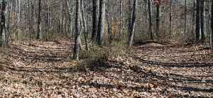
This early interstate road building venture produced a snake-infested, mosquito-beset, robber-haunted, Indian-pestered forest path. Lamented by the pious, cussed by the impious, it tried everyone's strength and patience. When the trail became so water logged that wagons could not be pulled through, travelers cut new paths through the nearby woods. Here you see three cuts made to avoid mud into which oxcarts and wagons sank, making progress slow, dangerous and even impossible.
Sunken Trace Photo Gallery