Columbia - Centerville Tennessee - Natchez Trace
This section of the Natchez Trace is located between Columbia and Centerville, Tennessee.
The section spans the area between the Tennessee Highway 7 intersection (milepost 416) and the US 412 intersection (milepost 391).
Listed below:

milepost 411.8 - Picnic Area, Scenic Overlook
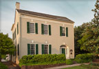
Gordon House and Duck River Ferry Site
milepost 407.7 - Restroom, History/Nature Exhibit, Old Trace, Indian History, Hiking Trail, Picnic Area, Top 30 Favorite Site
milepost 405.1 - Hiking Trail, Scenic Overlook, Top 30 Favorite Site
milepost 404.7 - Restroom, Hiking Trail, History/Nature Exhibit, Waterfall, Top 30 Favorite Site
Tobacco Farm and Old Trace Drive
milepost 401.4 - History/Nature Exhibit, Old Trace, Hiking Trail, Scenic Overlook
milepost 391.9 - Hiking Trail, Waterfall, Top 30 Favorite Site
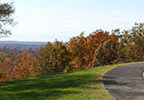
Scenery you can see from the road while driving, biking or riding the Columbia - Centerville section of the parkway.
Fall Foliage photos of the Columbia - Centerville section of the parkway.
President James K. Polk Home & Museum
Exit the Trace at milepost 416 onto TN Hwy 7 and travel south to Columbia, or milepost 408 onto TN Hwy 50 and travel east to Columbia or milepost 391 onto US 412 and travel east to Columbia.
Exit the Trace at milepost 416 onto TN Hwy 7 and travel south to Columbia, or milepost 408 onto TN Hwy 50 and travel east to Columbia or milepost 391 onto US 412 and travel east to Columbia.
Lewis County Museum of Natural History
Exit the Trace at milepost 391 onto US 412. Turn left and travel west 8.5 miles to downtown Hohenwald.
Exit the Trace at milepost 391 onto US 412. Turn left and travel west 8.5 miles to downtown Hohenwald.
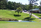
Hohenwald Municipal Golf Course
Exit the Trace at milepost 391 onto US 412. Turn left and travel west 5.5 miles.
Exit the Trace at milepost 391 onto US 412. Turn right and travel east 9 miles to Hampshire.
TN Hwy 7 exit (milepost 416):
- Natchez Trace Stables - Guided horseback rides on trails thru woods, meadows and creeks.
TN Hwy 50 (milepost 408):
- Fisher's Off-Road Rentals - Guided SXS tours/rides
- Back Country Grill - Pizzas and sub sandwiches just off the Parkway.
- Duck River Country Store - Old country store with grocery supplies and a grill.
US 412 exit (milepost 391):
- The Junkyard Dog Steakhouse - Open for lunch and dinner Wednesday thru Saturday and lunch on Sunday.
- Big John's BBQ - Open for lunch and dinner Monday thru Saturday and lunch on Sunday.
- Rio Colorado Mexican Restaurant - Open for lunch and dinner every day.
- Copperhead Creek Carpentry & Studio - Open Thursday, Friday and Saturday.
- Highland Realm Blueberry Farm - Blueberries available from mid-June through mid/late July.
- Amber Falls Winery and Cellars - Open in the afternoon 7 days a week.
- Natchez Hills Vineyard and Winery - Open in the afternoon Friday thru Sunday.
- Keg Springs Winery - Open in the afternoon Wednesday thru Sunday.
in Columbia via TN Hwy 7, TN Hwy 50 or US 412 exit:
- Puckett's Grocery & Restaurant: Columbia - Open for breakfast and lunch every day. Open for dinner on Friday and Saturday.
- Square Market & Cafe - Open for breakfast and lunch Monday thru Saturday. Open for dinner on Friday and Saturday.
If you are traveling south, exit the Trace at milepost 416 onto Tennessee Highway 7 and travel east to Columbia (17 miles). Or, if you are traveling north, exit the Trace at milepost 391 onto US Highway 412 and travel east to Columbia (24 miles).
If you are traveling south, exit the Trace at milepost 391 onto US Highway 412 and travel about 8 miles west to Hohenwald. Or, if you are traveling north, exit the Trace at milepost 386 onto Tennessee Highway 20 and travel about six miles west to Hohenwald.
Exit the Trace at milepost 391 onto US Highway 412 and travel east 9 miles to Hampshire.
- Tennessee Highway 7 - milepost 416 - Fly | Santa Fe | Columbia - Food nearby
- Tennessee Highway 50 - milepost 408 - Centerville | Columbia - Food & Gas nearby
- US Highway 412 - milepost 391 - Linden | Hohenwald | Hampshire | Columbia - Food nearby
- Mule Day Columbia - late March/early April
- Hohenwald Springfest Hohenwald - May
- Mid-South Live Steamers Columbia - May and September
- Arts & Crafts and Farmer's Market Fly - May and October
- Keg County Poker Run Motorcycle Tour Centerville - May
- Swine & Wine Hampshire - monthly April thru October
- Cajunfest Hampshire - late May
- Knap In - The Making of Arrowheads Fly - July
- Sunset Rhythm and Vines Hampshire - September
- Oktober Heritage Festival Hohenwald - October
- Meriwether Lewis Arts & Crafts Show Columbia - October
- Hohenwald Fall Classics Car & Truck Show Hohenwald - October

