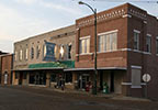
Tishomingo - Belmont Mississippi - Natchez Trace
This section of the Natchez Trace is located near Tishomingo and Belmont, Mississippi.
The section spans the area between the Alabama-Mississippi state line (milepost 308.9) and the Mississippi Highway 371 intersection (milepost 281).
Listed below:

milepost 293.2 - Modern Marvel, Picnic Area
milepost 286.7 - Restroom, Indian History, Top 30 Favorite Site
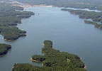
Scenery you can see from the road while driving, biking or riding the Tishomingo - Belmont section of the parkway.
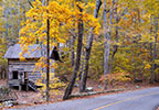
Fall Foliage photos of the Tishomingo - Belmont section of the parkway.
Corinth Civil War Interpretive Center
In Corinth, MS. If you are traveling north on the Trace, exit onto Mississippi Highway 145 near Tupelo, then go north on US 45 to Corinth. If you are traveling south on the Trace, exit onto US 72 at milepost 320 and travel west to Corinth.
The Trace goes through the state park. Exit the Trace at milepost 304.5.
On the east side of the Tennessee-Tombigbee Waterway exit the Trace at milepost 293.4. and go north to the lake and dam area.
MS Hwy 30 (milepost 307):
If traveling south, exit the Trace in Alabama at milepost 320 onto US Highway 72 and travel west 35 miles. If traveling north, access US 45 north of Tupelo and travel north 45 miles.
Exit the Trace at milepost 303 onto Mississippi Highway 25 and travel north 2 miles.
If traveling south, exit the Trace at milepost 303 onto Mississippi Highway 25 and travel south 7 miles. Or, if traveling north, exit the Trace at milepost 297 onto Mississippi Highway 4 and travel east to Mississippi Highway 25 and then south on highway 25.
- Mississippi Highway 30 - milepost 307 - Tishomingo
- Mississippi Highway 25 - milepost 303 - Tishomingo | Dennis | Belmont - Food & Gas nearby
- Mississippi Highway 4 - milepost 297 - Dennis | Belmont
- John Rankin Hwy / Tishomingo CR 1 - milepost 293.4 - Belmont
- Mississippi Highway 370/371 - milepost 282 - Baldwyn
- Iuka Renaissaince Day - Iuka - April
- Iuka Heritage Festival - Iuka - Labor Day Weekend
- Trash and Treasures Tenn-Tom Yard Sale - Tishomingo County - late September


