Lorman - Natchez Mississippi - Natchez Trace
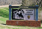
This section of the Natchez Trace Parkway is located between Lorman and Natchez, Mississippi.
The section spans the area between the Mississippi Highway 552 intersection (milepost 30) and the southern terminus of the Trace (milepost 0).
Listed below:

milepost 15.5 - Restroom, History/Nature Exhibit, Old Trace, Top 30 Favorite Site
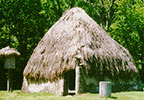
milepost 10.3 - Indian History, Top 30 Favorite Site
milepost 8.7 - History/Nature Exhibit
milepost 5.1 - History/Nature Exhibit
Scenery you can see from the road while driving, biking or riding the Lorman - Natchez section of the parkway.
Exit the Trace onto Mississippi Highway 553 at milepost 10.3 or at milepost 20 and go west.
Grand Village of the Natchez Indians
Exit the Trace at milepost 0 (southern terminus) onto Liberty Road. Turn onto U.S. Highway 61 South (Seargent S. Prentiss Drive). Turn left onto Jefferson Davis Boulevard. The Grand Village of the Natchez Indians will be on your right.
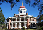
Exit the Trace at milepost 0 (southern terminus) onto Liberty Road. Turn left (go south) onto US 61 (Sgt. Prentiss Drive). Turn right (go west) onto US 84 (John R Junkin Drive). Turn left onto Lower Woodville Road - entrance to Longwood will be on the right.
Natchez Museum of African American History and Culture
Exit the Trace at milepost 0 (southern terminus) onto Liberty Road. Follow the signs to Downtown Natchez and Main Street.
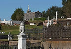
Exit the Trace at milepost 0 (southern terminus) onto Liberty Road. Follow the signs to Downtown Natchez. The cemetery is located a mile north of town on Cemetery Road.
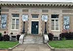
Natchez in Historic Photographs Gallery
Exit the Trace at milepost 0 (southern terminus) onto Liberty Road. Follow the signs to Downtown Natchez and Pearl Street.
Exit the Trace at milepost 0 (southern terminus) onto Liberty Road. Follow the signs to Downtown Natchez and State Street.
Exit the Trace at milepost 0 (southern terminus) onto Liberty Road. Follow the signs to Downtown Natchez. The cemetery is located a mile north of town on Cemetery Road.
Exit the Trace at milepost 0 (southern terminus) onto Liberty Road. Follow the signs to Downtown Natchez.
Exit the Trace at milepost 0 (southern terminus) onto Liberty Road. Follow the signs to Downtown Natchez. The visitor center is located on Main Street.
MS Hwy 552 exit (milepost 30):
MS Hwy 553 exit (milepost 20 and milepost 10):
Liberty Road exit (milepost 0):
Exit the Trace at milepost 0 (southern terminus) onto Liberty Road. Follow the signs to Downtown Natchez.
- Mississippi Highway 552 - milepost 30 - Alcorn | Lorman - Food nearby
- Mississippi Highway 553 - milepost 20 - Church Hill | Fayette
- Mississippi Highway 553 - milepost 10 - Church Hill
- US Highway 61 - milepost 8 - Natchez
- Liberty Road - milepost 0 - Natchez - Food & Gas nearby
- Natchez Mardi Gras - February
- Natchez Literary and Cinema Celebration - late February
- Historic Natchez Tableaux - mid-March thru mid-April
- Natchez Spring Pilgrimage of Antebellum Homes - mid-March thru mid-April
- Natchez Powwow - late March
- Natchez Euro Fest Classic European Auto & Motorcycle Show - early April
- Natchez Festival of Music - May
- Natchez Independence Day Fireworks on the Mississippi River - July 4th Weekend
- Natchez Food & Wine Festival - late July
- Natchez Fall Pilgrimage of Antebellum Homes - late September - early October
- The Great Mississippi River Balloon Race - mid-October
- Natchez Antiques Forum - early November
- Angels on the Bluff at the Natchez Cemetery - early November
- Christmas in Natchez - mid-November thru New Year's
