Kosciusko Mississippi - Natchez Trace
This section of the Natchez Trace is located near Kosciusko, Mississippi.
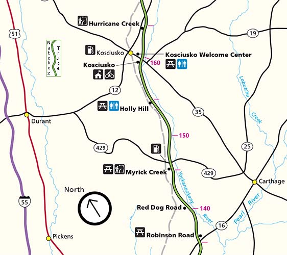
The section spans the area between the Mississippi Highway 12 intersection (milepost 166) and the Mississippi Highway 16 intersection (milepost 135).
Listed below:

Natchez Trace Historic and Scenic Sites
milepost 160.0 - Restroom, Picnic Area, History/Nature Exhibit
milepost 145.1 - Hiking Trail, History/Nature Exhibit
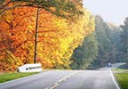
Scenery you can see from the road while driving, biking or riding the Kosciusko section of the parkway.
Fall Foliage photos of the Kosciusko section of the parkway.
Area Merchants
MS Hwy 35 exit (milepost 160):
- Rodeo Family Mexican Restaurant - Open for lunch and dinner every day.
- Jason's Southern Table - Open for dinner Wednesday thru Sunday.
- Bel Piatto Italian Restaurant - Open for breakfast, lunch and dinner every day.
- Los Cabritos - Authentic Mexican Grill - Open for lunch and dinner every day.
- No. 1 China Buffet - Open for lunch and dinner every day.
Nearby Towns & Cities
Exit the Trace at milepost 160 at either the Kosciusko Information Center or Mississippi Highway 35 and travel west 1 mile.
Access / Exit Roads - Nearby Towns & Cities and Food and Gas nearby? (less than 2 miles)
- Mississippi Highway 35 - milepost 159 - Kosciusko - Food & Gas nearby
- Mississippi Highway 429 - milepost 146 - Carthage
- Mississippi Highway 16 - milepost 135 - Canton | Carthage - Food & Gas nearby
Area Festivals & Events
- Passion Play - Easter Weekend
- Natchez Trace Festival - last Saturday in April
- Central Mississippi Fair - first Wednesday thru Saturday of August


